1. About Cong Dam Area — Key Facts at a Glance
| Detail |
Information |
| Location |
Bai Tu Long Bay, Quang Ninh Province, Vietnam (northeastern section, Route 4) |
| Known as |
“Outdoor geological museum” of Bai Tu Long Bay |
| Geological age |
Limestone formations approximately 340 million years old |
| Geological USP |
Horizontally layered rock stacked in perfectly straight lines — unique in the bay region |
| Fishing village |
~120 residents; widely described as having “the most intact traditional fishing culture” in the bay |
| Beaches |
Tra Gioi — Cay Bang — Cat Oan (white sand, crystal-clear water, no crowds) |
| Cong Dam Cave |
Approximately 240 m long — over 1,000 m2 interior area |
| Marine ecosystem |
Coral reefs — underwater caves — lakes inside limestone mountains |
| Activities |
Kayaking — swimming — mangrove planting — fishing with locals — bamboo boat village tour |
| Cruise route |
Halong Bay Sightseeing Route 4 — departs from Hon Gai Port (Halong City) |
| Recommended cruise |
3-day 2-night Bai Tu Long Bay cruise; Cong Dam typically on Day 2 |
| Nearby attractions |
Thien Canh Son Cave — Vung Vieng Village — Cap La Island |
2. Location & Setting
Cong Dam Area is situated in the northeastern section of Bai Tu Long Bay — the least-visited and most remote part of the wider Halong Bay region. Its position well beyond the standard cruise routes that serve Halong Bay’s central zone (Sung Sot Cave, Ti Top Island, Cua Van Village) means that Cong Dam receives a fraction of the visitor numbers those attractions see each day — and that isolation is precisely what gives the area its defining character: pristine water, undisturbed marine ecosystems, and a fishing village whose traditions have been maintained intact precisely because so few outside influences have reached it.
Cong Dam is most commonly visited as part of the longer Route 4 Bai Tu Long Bay cruise itinerary, which typically includes Vung Vieng Fishing Village, Thien Canh Son Cave, and Cap La Island — forming together the most complete and diverse Bai Tu Long Bay experience available. The area is specifically served by cruises departing from Hon Gai Port in Halong City (not Tuan Chau Marina, which serves Halong Bay Route 1 and Route 2 traffic).
The landscape of Cong Dam is defined by what geologists describe as a concentration of the bay’s most ancient and structurally distinctive rock formations — the horizontally layered limestone described in detail in Section 3 below, surrounding a network of beaches, coral reefs, caves, and the floating village that together make Cong Dam feel less like a tourist attraction and more like a complete, self-contained natural world.
3. The Geological Museum: 340 Million Years on Display
The phrase most consistently applied to Cong Dam Area by cruise operators, tourism guides, and independent travel writers across more than a decade is “outdoor geological museum” — and it is not marketing hyperbole. The limestone formations surrounding Cong Dam are genuinely and visibly different from those found elsewhere in Halong and Bai Tu Long Bays, in a way that is immediately apparent to visitors even without geological training.
What makes Cong Dam’s geology unique?
While most limestone karst formations in Halong Bay present as rounded, organic-looking masses of rock — the product of millions of years of wave and wind erosion eating away at softer material — the mountains around Cong Dam Area display a distinctly different structural character: the limestone here is arranged in horizontal layers, stacked in near-perfectly straight lines, creating cliff faces that resemble massive books stacked on their sides, or giant staircases cut from grey stone. This layered bedding pattern reflects the original deposition of calcium carbonate sediment on an ancient sea floor over 340 million years ago — before the bay’s geological upheavals lifted this seafloor into the mountains visible today. It is, literally, the Earth’s deep past made visible at the surface of the water.
The geological formations of Cong Dam are part of the same limestone system that makes the entire Halong Bay — Cat Ba Archipelago a UNESCO World Heritage Site, but at Cong Dam the exposed stratigraphy is among the oldest and most clearly readable anywhere in the bay. This is why the area has been called a “regional park” in recognition of its scientific and educational significance, alongside its scenic beauty.
Beyond the karst formations themselves, Cong Dam Area contains coral reefs in the shallow waters between the islands, underground lakes inside the limestone mountains accessible only by kayak or small boat, and a series of underwater caves that extend from the cliff bases below the waterline — making the area’s geological drama three-dimensional, visible both above and below the bay’s surface.
4. The Beaches: Tra Gioi, Cay Bang & Cat Oan
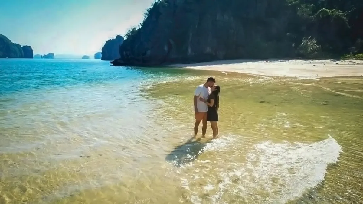
Cay Bang Beach in Cong Dam Area — named for the sea almond trees that provide natural shade along its shoreline. One of three pristine, virtually undeveloped beaches (Tra Gioi, Cay Bang, Cat Oan) in Bai Tu Long Bay’s most remote and unspoiled zone.
Cong Dam Area is home to three named beaches that rank among the most genuinely pristine in the entire bay region — not because they are particularly dramatic in scale, but because of what they are not: not crowded, not developed, not managed for mass tourism, not accessible to the day-trippers who flood Ti Top Island and Ban Chan Beach on peak weekends.
Tra Gioi Beach
The most frequently mentioned of the three Cong Dam beaches, Tra Gioi offers fine white sand and clear, shallow water in a setting enclosed on multiple sides by limestone formations. The name (“Tra Gioi” means roughly “world of tea” — likely named for a native plant species growing on the surrounding hills) contributes to the sense of a place that has been known and named by local fishermen for generations, but has never been formally developed for tourism. Kayakers from nearby cruise ships typically arrive mid-morning and leave by early afternoon, leaving the beach effectively private outside those windows.
Cay Bang Beach
Named after the Cay Bang (sea almond or tropical almond) trees that line its shore, Cay Bang Beach provides natural shade from the broad, flat canopy of these distinctive coastal trees — a rare amenity on bay beaches where shade is usually absent. The combination of sandy beach, shaded tree line, and the characteristic straight-layered cliff faces of Cong Dam rising immediately behind creates one of the most compositionally striking beach scenes in Bai Tu Long Bay. Cruise operators frequently anchor near Cay Bang for beach BBQ lunches, taking advantage of the natural shade and the beach’s calm, clean water.
Cat Oan Beach
The most secluded of the three beaches and the one closest to the fishing village, Cat Oan (“wild duck”) Beach is a favourite with kayakers who explore the Cong Dam area independently from their cruise ship. Reaching it requires paddling through one of Cong Dam’s limestone channels — a 10-15 minute journey that itself provides close-up views of the geological formations and the coral-rich shallow water below — before emerging into a quiet cove of white sand that few visitors outside of Bai Tu Long Bay overnight cruises will ever see.
5. Cong Dam Fishing Village
The fishing village at the heart of Cong Dam Area is, by multiple independent assessments, the most culturally preserved and least tourism-influenced floating fishing community in the entire Halong and Bai Tu Long Bay region. With a population of approximately 120 people — smaller than Vung Vieng (~several dozen remaining households), Cap La (~80 households / 200 people), and far smaller than Cua Van (176 households / 733 residents in Halong Bay) — Cong Dam’s community is the smallest of the bay’s active floating villages.
What distinguishes it from the others is not its size but its completeness: the full cycle of traditional fishing culture still operates here — net-making, cage-building, squid fishing by lamplight at night, early morning fish sorting, aquaculture management — in a setting so remote that modern influences have arrived slowly and selectively. The village children attend a small school on-site; visitors who have been rowed through the village on bamboo boats by local women describe seeing a one-room schoolhouse, a tiny community museum, and fishing boats of every function lining the narrow waterways between the floating homes.
The village has no grid connection to the national power supply — residents rely on solar panels and generators — and the water around the homes is noticeably cleaner than at the more-visited Cua Van and Vung Vieng, a direct result of both the remoteness and the lower tourism footprint. Visitors to Cong Dam are genuinely welcome: the community’s isolation has produced warmth rather than wariness toward outsiders, and the opportunity to hear stories of surviving typhoons on the open water, maintaining fishing traditions across generations, and living entirely within the resources of the bay is one of the most honest and moving cultural encounters available anywhere in the bay region.
A note on the village’s future: The Vietnamese government’s programme to relocate bay-dwelling fishing families to mainland housing (for better access to education, healthcare, and infrastructure) has been operating across all Halong and Bai Tu Long Bay villages for over a decade. Cong Dam’s extreme remoteness means this process is still actively underway — some families have moved, others remain by choice. The community’s long-term population may continue to shrink. Visiting now preserves the experience of encountering a genuinely intact fishing culture before the last generation decides to leave the water.
6. Cong Dam Cave
Cong Dam Area contains its own cave — Cong Dam Cave — a grotto of approximately 240 meters in length with an interior area of over 1,000 square meters, making it a substantial karst formation by Bai Tu Long Bay standards. The cave is part of the same limestone system that defines the area’s geological distinctiveness, and its interior reflects the same horizontally-bedded rock structure visible on the cliff faces outside — in the cave’s case creating unusual ceiling and wall formations shaped by the natural layering rather than the more random organic shapes found in caves like Thien Canh Son.
The cave is less formally developed for tourism than Thien Canh Son Cave — there is no long staircase to the entrance, no electric lighting, and the experience is generally more self-directed and exploratory. This makes it particularly popular with visitors seeking an adventure cave experience rather than a guided illuminated walk-through. Visiting the cave typically involves rowing or kayaking to the entrance by small boat.
7. Activities: Kayaking, Mangrove Planting & Fishing
Kayaking
Kayaking is the primary way most visitors experience Cong Dam Area, and the combination of geological formations, beach options, and sheltered channels makes it ideal for it. The typical kayaking session covers the channels between the limestone islands around Cat Oan, Tra Gioi, and Cay Bang — approximately 45-90 minutes of paddling through one of Bai Tu Long Bay’s most visually dramatic water-level environments. The horizontally layered cliff faces are most visible and most impressive at water level, where the scale of the geological bedding is impossible to ignore. Mandatory pairing rule (double kayaks only) applies across all Bai Tu Long Bay cruise itineraries.
Mangrove Planting
One of Cong Dam’s most distinctive — and most meaningful — visitor activities is participating in mangrove planting alongside local conservation programs. The mangrove forests that fringe the limestone islands of Bai Tu Long Bay are critical nursery habitat for the bay’s fish populations, coral health, and coastline stability. Several cruise operators include a mangrove planting session as part of the Cong Dam stop — visitors are given seedlings and shown how to plant them in the tidal zone under the guidance of local fishermen who maintain the program. It is a short, simple activity (15-20 minutes) that provides a direct and tangible contribution to the bay’s long-term ecological health, and which most visitors find more memorable than they expect.
Fishing with Locals
Cong Dam’s fishing village offers the most authentic fishing experience available in the bay region — not a performance for tourists, but an invitation to join working fishermen in their actual routines. Activities include accompanying fishermen to check fish cages, learning to cast traditional nets, participating in squid fishing at night by lamplight (one of the cruise ship evening activities many operators offer when anchored near Cong Dam), and helping to sort the day’s catch on the boat deck. The experience is unhurried, candid, and conducted in the genuine rhythm of the village’s working day rather than on a tourist schedule.
Bamboo Boat Village Tour
The standard way to visit Cong Dam fishing village from the cruise ship is by bamboo boat — small traditional rowboats paddled by village women through the narrow waterways between floating homes. The 20-30 minute journey takes visitors past the fishing cages, oyster rafts, nets hung to dry, playing children, cooking smells, and open doorways that constitute the village’s daily life. It is the same model as the bamboo boat tour at Cua Van in Halong Bay, but with one significant difference: at Cong Dam, the number of other tourist boats in the water at the same time is dramatically lower, creating a more intimate and less staged experience.
8. How to Visit Cong Dam Area in 2026
Cong Dam Area is accessible only via overnight Bai Tu Long Bay cruise on Route 4, departing from Hon Gai Port (Halong International Passenger Port) in Halong City. This is an important logistical distinction: most Halong Bay cruise packages depart from Tuan Chau Marina, which serves Route 1 and Route 2 (the standard Halong Bay sightseeing routes that do not reach Bai Tu Long Bay). Route 4 to Cong Dam specifically requires Hon Gai Port departure.
| Cruise Type |
Duration |
Cong Dam Included? |
| Halong Bay standard cruise (Route 1/2) |
2D1N or 3D2N |
No — Tuan Chau departure, Route 2 only; does not reach Cong Dam |
| Bai Tu Long Bay cruise 2D1N |
2 days, 1 night |
Sometimes — confirm Cong Dam specifically; shorter itineraries may skip it |
| Bai Tu Long Bay cruise 3D2N |
3 days, 2 nights |
Most likely — Cong Dam typically on Day 2; enough time for all activities |
Cruise Operators Known to Include Cong Dam
Cruise lines with confirmed Cong Dam Area itineraries (verify current programmes before booking): Signature Cruise, Dragon Legend Cruise, Athena Cruise, Renea Cruise, Swan Cruise, Indochina Junk, V’Spirit Cruises, among others. Always confirm Cong Dam is explicitly named in the itinerary.
Getting There
- From Hanoi: Approximately 3-3.5 hours by road to Hon Gai Port (Halong International Passenger Port), Halong City
- Note: This is a different departure port from Tuan Chau Marina — confirm your cruise departure point when booking
- Cruise journey to Cong Dam: Approximately 2-3 hours from Hon Gai into Bai Tu Long Bay; Cong Dam is one of the more distant stops
-> Browse Bai Tu Long Bay cruises that include Cong Dam Area ->
9. Best Time to Visit Cong Dam Area
| Season |
Months |
Conditions |
Rating |
| Foreign tourist peak (ideal) |
Nov — March |
Clear skies, dry, cooler temperatures; 10-20 degrees C — perfect for kayaking and outdoor activities; the most popular period for international visitors |
⭐⭐⭐⭐⭐ Best overall |
| Shoulder spring |
April — May |
Pleasant temperatures warming up; light rain beginning; good for beach activities; fewer crowds than peak |
⭐⭐⭐⭐⭐ Excellent |
| Vietnamese domestic peak |
April — October |
Warmer weather, ideal for swimming; more domestic visitors; June-August highest storm and typhoon risk |
⭐⭐⭐ Variable |
| Typhoon season |
Jun — Aug |
Bai Tu Long Bay’s northeastern position increases weather exposure; highest disruption risk to cruise itineraries |
⭐⭐ Caution — check forecasts |
For international visitors: November to March is the prime window — clear visibility for the geological formations, dry paths, calm seas. October and November offer the best light quality for photography. Avoid June to August if possible: Cong Dam is one of the most exposed areas in the bay, and typhoon disruptions are most likely during these months.
10. Practical Tips Before You Go
- Book a 3D2N Bai Tu Long Bay cruise for the best experience. Cong Dam is typically on Day 2 of a 3D2N itinerary — the longer schedule allows proper time for all activities (kayaking, beach, village tour, mangrove planting) without rushing.
- Departs from Hon Gai Port, not Tuan Chau. This is the most commonly overlooked logistical point — confirm your cruise’s departure port before booking, and arrange transport to Hon Gai Port specifically.
- Confirm Cong Dam is explicitly on the itinerary. Not every Bai Tu Long Bay cruise includes Cong Dam Area specifically — always verify before booking.
- Bring reef-safe sunscreen. The coral reefs of Cong Dam are among the most pristine in the bay — chemical sunscreen is harmful to coral ecosystems.
- Kayak in pairs (mandatory). Solo kayaking is prohibited across all Bai Tu Long Bay itineraries.
- Bring VND cash for any direct purchases from village residents — there are no ATMs or card facilities at Cong Dam.
- Budget 2-3 hours for the full Cong Dam experience: 45-90 minutes kayaking, 30 minutes beach, 30 minutes village bamboo boat tour, optional 15-20 minutes mangrove planting.
- Take the mangrove planting activity if offered. It is unusual, meaningful, and — based on visitor accounts — surprisingly moving to do something directly beneficial for the bay’s ecosystem while you are in the middle of it.
11. Cong Dam Area — Frequently Asked Questions
The questions we get asked most often by travelers planning to visit Cong Dam Area in Bai Tu Long Bay.
Both are in Bai Tu Long Bay, but they offer meaningfully different experiences. Vung Vieng is the better-known of the two, included on more cruise itineraries, with a slightly larger community and the famous Cao Cave bamboo boat gateway. Cong Dam is more remote, has a smaller community (~120 people), sees fewer cruise visitors, and is embedded within the extraordinary geological landscape of the “outdoor geological museum” area — giving it a more dramatic natural setting. Cong Dam also uniquely offers the mangrove planting experience and the three named beaches (Tra Gioi, Cay Bang, Cat Oan) as part of the same stop. If visiting for cultural authenticity and fewer crowds, Cong Dam edges ahead; if visiting on a shorter itinerary, Vung Vieng is more accessible.
Last updated: June 2026 | Information verified against multiple Bai Tu Long Bay tourism sources including HalongHub (Jan 2026), BestPrice Travel, HalongBayCruises.com, OriginVietnam, SwanCruises Halong, Indochina Junk, V’Spirit Cruises, and TripAdvisor visitor reviews. Village population (~120) is one of the most consistently reported figures across all sources (8+ independent confirmations). Geological age (340 million years) confirmed across 4+ independent sources. Cave dimensions (240m, 1,000m2) from BestPrice Travel — confirm current access status with cruise operator.